Northward bound – through Alberta and British Columbia
30th July – 6th August, 2015
After the 2-week pause in Edmonton, and what feels like months in the flat lands, we couldn’t wait to finally be in the mountains again. We had an almost homesick feeling for the mountains and were quite excited to finally be on the way again.
On Route 40
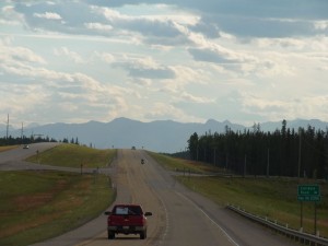 Because of our homesickness for the mountains we decided not to take the direct route up north, instead we chose to do a little side trip along Route 40 to get a little taste of the fresh mountain air. After a number of hours driving the highway through the flat lands west of Edmonton on highway 16 we finally got a glimpse of mountains on the horizon. We haven’t seen anything like that since leaving our little village in the Allgäu and had almost a feeling of coming home. As we arrived at the William A. Switzer Provincial Park we noticed that, much like in Allgäu, there is quite a big difference in temperature. So for the first time in a long time we cooked our meal in the cool fresh mountain air. The next day we hopped on our bikes and decided to do a little mountain biking. We soon realized that we’re really out of shape; our legs started to complain the first time it went uphill and sweat started to flow freely…
Our next stop was Grand Cache, were the “Canadian Death Race” ultra marathon was being held. The name is quite appropriate; it’s a 125 km race that has to be completed within 24 hours, along the way the participants have cross several mountain peeks with an altitude difference of 5180 meters! You can either run the entire thing yourself or in a team of 5, but the real tough people run the whole thing themselves, and in much less than the required 24 hours. Somehow totally superhuman we find. So of course Grand Cache is totally full with runners and spectators and everything is booked solid but we got really lucky at an outlying campground, that can’t be pre-booked, and managed to get the last available spot. We took advantage of the beautiful summer weather by going on a stroll to a look-off overlooking the Sulphur Gates and then returned to enjoy the competition atmosphere of the death race runners at our campground as they prepared to start the next morning.
We contented ourselves instead with a small hike to Eaton falls before we headed towards Grand Prairie. What really stuck out along the whole way of highway 40 is that there are tremendous amounts of wild camping spots, or random camping as they call it here, some of them really nicely situated and most important completely legal!
When something is called “Prairie” then you can pretty much bet that it’s going to be flat. So we weren’t really all that surprised to find that once we reached Grand Prairie we were, once again, completely out of the mountains surrounded by vast fields. Somehow that just felt like a too short of a side trip, we stocked up on provisions and headed out in the direction of British Columbia.
Alaska Highway
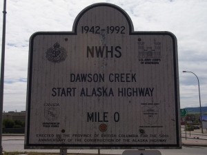 The famous highway starts in the town of Dawson Creek. A really big sign and a tourist information center declare that a big adventure is about to start. We also decided to make sure we had a list of gas stations, campgrounds, where we can get potable water etc. and also suddenly noticed that it’s all a bit more touristy here, which of course means that you get a lot less individual information. We were also expressly warned not to drink the water out of any rivers, streams or wells in the region. Apparently we are currently in an intensive fracking region and the ground water quality has been affected, we weren’t sure whether it’s true or not but we didn’t want to take a chance. You think you are in a remote area were that water is crystal clear and pure and it can’t get any better than here, only to find out that the exploitation of the earth happens everywhere even, or especially, in remote areas. Our mood is a little bit cloudy as we head out of Dawson Creek, and doesn’t improve much at first. “Alaska Highway” it sounds so adventurous and exciting, but sadly the start is not exciting at all. Before it starts getting interesting you have to drive through endless stretches of monotonous landscapes, the only plus is on a newly paved highway. We drive and drive though endless forests pass by towns and villages with promising names like: “Fort St. John” or “Buckinghorse River” only to find out that they consist of one or two houses. As for places to camp along the way it was looking pretty poor. The slim pickings that were available were not much more than a parking lot, picnic spots don’t exist (although enough signs along the way indicate that they do – there isn’t anything except a garbage can), and so there wasn’t much we could do except use one of the ugly pull-offs next to the road to camp for the night. Somehow we didn’t imagine the adventure road this way. However it didn’t look like it was better for anyone else as someone occupied almost every pull-off along the way with a camper or tent, apparently they hadn’t found anything better either.
The next day we were greeted with rain. Not really wanting to spend any more time than absolutely necessary at this rather depressing spot we packed up and left without breakfast heading directly for Fort Nelson (another one of those names) looking for a hot breakfast and an even hotter shower. The first we ended up finding relatively quickly at a hotel with a rather interesting atmosphere. People from all walks of life are sitting at the someone run down tables: Bearded men in dirty work clothes, travelers and long time travelers, business people in suits and us. After a big breakfast of home fries, bacon, eggs and cheese (the milk free experiment is over and it’s the first cheese in over 5 weeks) the world looks like a much better place. It’s nice to find a breakfast menu that keeps its promises! We also soon found a place to shower and for a reasonable price too. Freshly showered and still enjoying the feeling our breakfast gave us we left Fort Nelson hoping for a better day on the Highway.
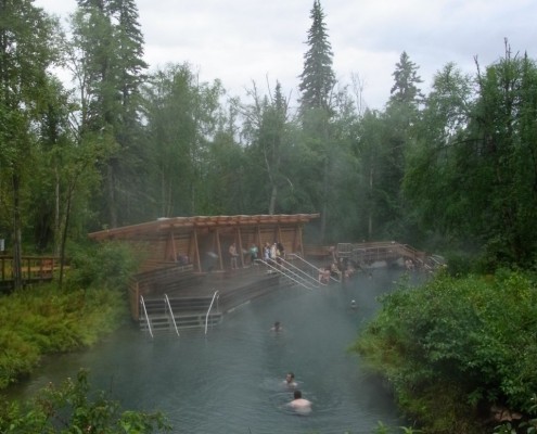
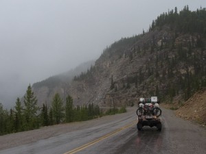 Shortly thereafter the highway actually does become more interesting. We headed once again into mountainous areas and passes. Even though it was pouring down with rain the whole time it didn’t seem to take anything away from the wonderful landscape. Along the way we experienced our second culinary highlight of the day. Approximately 10 km from Teslin River stood a sign with “Hot Cinnamon Buns” on the side of the road, and then repeated every few kms until we almost started drooling in anticipation, of course we had to stop and buy one. The marketing ploy worked like a charm; the $5 for the huge bun was worth every penny! We spent the night at the wonderful turquoise blue Mancho Lake camp ground and wanted to spend the following day exploring the hiking trails in the area, however it was raining like hell the next day and so we decided that it would be better to pack up and head directly for Liard River Hot Spring, which turned out to be a major highlight on our way north.
“Prairie Cows” in the Mountains
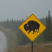
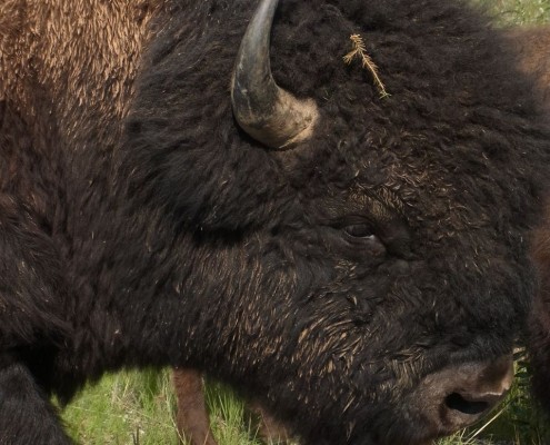
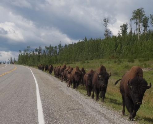
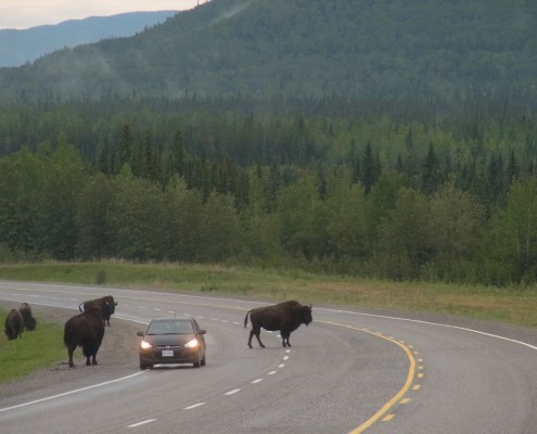
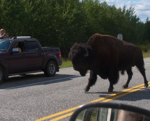
Along the way, and also after Liard, we experienced something very special: Wild Bisons, and the largest of all, Wood Buffalos! Ok we saw some in Manitoba and were excited to see the huge animals but they were caged in and although wild they weren’t free roaming like these ones so it was quite a different experience. We passed several herds and bachelor bulls walking either in the middle of or directly next to the road. The animals didn’t seem to notice us in the least and walked so close to our car that you could pet them. It reminded us a bit of the cows in the Alps – it’s no wonder really why they call them prairie cow we guessed. Somehow it was almost the same friendly and somewhat stoic nature that you would experience with an Alpine cow, with the huge exception that I wouldn’t want to stand next to one of the massive Bison bulls! It was definitely an impressive experience and we spent quite a bit of time taking picture and simply observing the herd as they grazed the grasses along the highway.
A Couple “Nice” Souvenirs
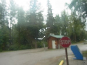 The Alaska Highway had a few other surprises for us in store: We were still driving on the paved highway, however here and there we were suddenly confronted with loose gravel.
 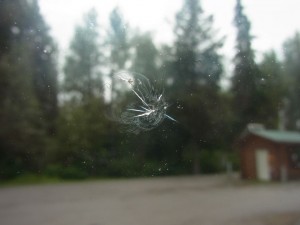 The signs posted read: “Loose gravel, drive slowly” but apparently we were the only ones to really pay attention as most of the folks coming the other direction didn’t seem to slow down in the least… with the results that we ended up with the first chips in our windshield. And while we talked about how shitty it was to get a bulls’ eye now after travelling all the way along the Labrador highway with nothing we hear the “CRACK” of the next stone hitting the windshield. We sat there pretty much speechless and felt a bit helpless. Two chips in the windshield in a matter of minutes… This could be interesting… We noticed in Alberta that just about every other car had a cracked windshield and now it’s all becoming clear why. We decided immediately to slow down and move to the side when a car comes the other way on the gravel roads, which of course doesn’t guarantee anything..
Liard River Hot Springs
As we already mentioned the hot springs at Liard River was a highlight for us on the way to the Yukon. Since we both have never experienced natural hot springs before we really didn’t know what to expect or even if we would enjoy ourselves what with it raining and all. Wow the water was hot, really hot! So hot in fact that we needed a bit of time to get used to the heat, and that turned out to be prefect since it was a cold rainy day. It was glorious to sit in the hot water and feel the cool rain from above and in a wonderful natural setting. It wouldn’t have been nearly so enjoyable by hot weather so we were actually thankful to have had the rain.
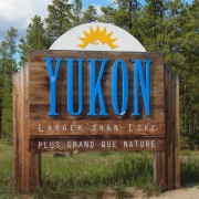
After our “swim” we felt like we had visited the Sauna – an all around relaxed feeling that held until the next day as we continued our journey into the Yukon.
More Photos on Flickr: Northward Bound



Saw you last night in Nanaimo — pulling out of the plaza where Cabelas is located….happy trails to you!